
Tech
How Often Should You Update Your Marine Navigation App Charts?
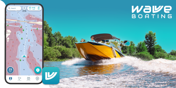
For any boater, updating digital charts regularly is crucial for safety and efficiency on the water. Whether you’re cruising, fishing, or sailing, using a reliable marine navigation app is only effective if the charts within it are up to date. But how often should you update them? The answer depends on the type of waters you’re navigating, how frequently you go boating, and the kind of data changes happening in your region.
Why Updating Charts Matters?
Marine environments are dynamic. Channels shift, new hazards emerge, buoy positions change, and updates to restricted or no-go zones are introduced. Relying on outdated charts—even by a few months—could lead to costly mistakes or dangerous situations. For example, if a sandbar has shifted or a new underwater obstruction has been added, and your app doesn’t reflect that, you could risk grounding your vessel.
Additionally, government authorities and hydrographic services frequently revise marine data based on ongoing surveys, accident reports, and reports of weather-related damage. Updating your charts ensures you’re navigating based on the latest available information.

How Often Are Official Charts Updated?
Most hydrographic offices, such as the Australian Hydrographic Office or NOAA in the U.S., release updates on a weekly or fortnightly basis. These updates are often pushed directly to apps through downloads. If your marine navigation app is linked to official government data sources, it’s likely to receive updates at least once a week.
Apps like Navionics, C-MAP, and Aqua Map offer “Chart Updates” that can be applied either automatically or manually, depending on your settings. Some apps require an annual subscription to receive these updates, while others provide lifetime access.
Recommended Update Frequency Based on Usage
Here’s a simple guide to help determine how often you should update your marine charts:
- Frequent Boaters (Weekly or Monthly Trips): Update charts every week or before each trip. This ensures you’re aware of any recent changes that could impact navigation.
- Seasonal Boaters (Monthly or Seasonal Trips): Update once a month during the boating season and immediately before heading out after any extended break.
- Casual Boaters (Occasional Users): At a minimum, update charts before each outing to avoid relying on outdated data.
- Offshore or Remote Region Navigators: Always download the latest charts before departure and ensure offline access in case of limited signal coverage.
Automatic vs. Manual Updates
Many apps offer automatic updates when connected to Wi-Fi or mobile data. Enabling this feature ensures you’re always running the latest charts without needing to update them manually.
However, some users prefer manual updates to avoid using up mobile data or to review update logs before downloading. Whichever method you choose, ensure updates are applied before setting out, especially in unfamiliar waters.
What Else Should Be Updated?
It’s not just charts that need regular updates. You should also ensure:
- Tide tables and current predictions are refreshed
- AIS (Automatic Identification System) data is updated if your app supports it
- Weather overlays and satellite imagery are up to date.
- The firmware of your device and connected systems is up to date for compatibility.
These additional updates enhance overall performance, ensuring your marine navigation app provides the most accurate and comprehensive guidance available.

Signs Your Charts May Be Outdated
Even if your app doesn’t prompt you, here are a few signs your charts need updating:
- New buoys or markers are not showing
- Recent construction or dredging is missing from maps
- Route plotting errors or mismatches with real-world visuals
- Charts load slowly or behave unpredictably.
If you notice any of these, it’s time to check for updates or contact the app’s support team.
Don’t Let Outdated Charts Cost You
Failing to keep your navigation charts current can lead to more than inconvenience. It can cause groundings, collisions, or violations of restricted areas. Not to mention, many marine insurers will reject claims if an incident occurred while using outdated navigation tools.
If you’re using a free app, be especially cautious—some free versions limit update frequency or restrict access to premium chart layers. If you’re exploring unfamiliar areas, investing in a subscription might be worth the peace of mind.
For extended voyages or fishing trips, pairing your chart updates with real-time weather data is a smart move. For high-accuracy forecasting, PredictWind weather updates are widely used among professional sailors and offshore navigators.
Final Thoughts
Regularly updating your marine navigation app charts is a small task that delivers huge safety and performance benefits. Whether you’re cruising through calm harbors or tackling open seas, make it a habit to check for chart updates before you go. It’s one of the simplest ways to ensure your time on the water stays enjoyable—and safe.

Why Kitchen Cabinets Start Swelling After a Pest Infestation

Top Cosmetic Surgery Prices Explained: Balancing Cost and Quality

Where to Buy Real Facebook Views in 2025 : Best Platforms

Best Sites to Buy YouTube Watch Time That Counts Toward Monetization

How to Get Famous on TikTok in 2025

How Streamoz Supports Long-Term Twitch Channel Growth

The Key to Instagram Potential: The Smart Way to Get More Views

Trichoderma harzianum: A Natural Shield Against Root Rot and Leaf Diseases in Peppers

Pike Fishing Essentials: Choosing the Right Lure

The Different Types of Water Storage Tanks: Which One Is Right for You?

Executive Bio – Preska Thomas – Founder & Visionary of DebitMyData™

Free Methods to Recover Lost Files from External Hard Drives

Contingency Management in Addiction Treatment: A Path to Lasting Recovery

Discover the Ultimate Storage Solution: Why You Need a Patiowell Metal Shed
